
Earth's landscapes significantly influence global precipitation patterns through topographical features like mountains and coastlines, affecting air mass movement and rainfall distribution. Climate variables, such as temperature and humidity, play pivotal roles in shaping weather. Land cover types, from forests to urban areas, further modify local microclimates and precipitation. Atmospheric conditions, fronts, and temperature variations create areas of low pressure, leading to increased precipitation. Global weather patterns are intricately linked through ocean currents and events like El Niño. Understanding these complex interactions is crucial for accurate weather forecasting, disaster preparedness, water resource management, and adaptation to climate change, enabling communities to navigate severe weather events naturally.
Precipitation patterns are a fundamental aspect of Earth’s climate system, yet their variability across landscapes remains a complex subject of study. Understanding why rain and snow fall unevenly on different terrains is crucial for predicting weather events and managing water resources effectively. This article delves into the intricate factors influencing precipitation variation, from topographical features like mountains and valleys to atmospheric conditions and local microclimates. By exploring these elements, we gain valuable insights into nature’s intricate dance of weather patterns, enabling us to better anticipate and adapt to our ever-changing environment.
- Topographic Influences on Rainfall Patterns
- The Role of Climate in Shaping Precipitation
- Land Cover's Impact on Water Cycle Dynamics
- Atmospheric Conditions and Weather Variations
- Regional Differences: Global Precipitation Trends
Topographic Influences on Rainfall Patterns

The Earth’s diverse landscapes play a pivotal role in shaping precipitation patterns, with each terrain presenting unique characteristics that influence weather conditions. Topographic features, such as mountains, valleys, and coastlines, act as natural barriers and guides for air masses, thereby significantly impacting rainfall distribution globally. For instance, the iconic Rocky Mountains in North America demonstrate this effect vividly; the range’s elevation causes upward movement of humid air, resulting in substantial snowfall on the peaks and heavier precipitation on the windward side, while leeward regions experience drier conditions. This phenomenon is not isolated to mountains; similar principles apply to other topographical elements like coastal plains and mountain ranges worldwide.
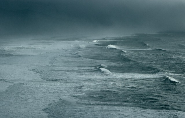
Halos, atmospheric optical phenomena, serve as visual indicators of these weather patterns. When a sunbeam passes through ice crystals in cirrus clouds, it bends, creating a circular halo around the sun or moon—a tangible sign of high-altitude air movement. This natural occurrence offers valuable insights into atmospheric conditions that drive precipitation. Tropical cyclones, another significant weather event, also exemplify the interplay between land and sea in shaping rainfall. These massive storms are fueled by warm ocean temperatures and can bring extreme precipitation to coastal areas upon making landfall. Advanced weather forecasting techniques, including radar technology, play a crucial role in predicting such events. For instance, weather radar technology provides real-time data on storm intensity and movement, enabling meteorologists to issue timely warnings for areas at risk, especially in regions with varying topographies like polar vs tropical climates.
Understanding these topographic influences is essential for accurate weather forecasting and preparing communities for potential impacts. By studying how mountains, coasts, and other landforms modify air masses, meteorologists can enhance their predictive models. This knowledge allows us to anticipate local variations in rainfall, enabling better water resource management, disaster preparedness, and informed decision-making for various sectors, from agriculture to urban planning. In the dynamic world of weather, these insights are invaluable, especially as we continue to explore and develop both natural and technological solutions to navigate our ever-changing climate.
The Role of Climate in Shaping Precipitation
Precipitation patterns across different landscapes are significantly influenced by climate, which acts as a pivotal force in shaping weather conditions where we live and work. The variation in precipitation is driven by complex interactions between several atmospheric and oceanic factors, with air temperature and humidity playing key roles. In humid regions, warmer air can hold more moisture, leading to increased condensation and subsequent rainfall. Conversely, dry air has lower moisture content, resulting in less frequent but often heavier precipitation events.
Temperature measurement is crucial in understanding these variations. Warmer air rises, creating convection currents that can lead to storm formation. Coastal areas, for instance, often experience moderate climates due to the oceanic currents effect, which moderates temperatures and contributes to consistent rainfall patterns. In contrast, arid regions may see less precipitation despite high humidity because of lower atmospheric pressure, causing moisture to evaporate quickly rather than condense into clouds and rain.
The collection and analysis of meteorological data from around the globe have revealed intricate relationships between ocean currents, temperature gradients, and precipitation. For instance, El Niño events in the Pacific Ocean can alter weather patterns worldwide, resulting in drier conditions in some regions and heavier rainfall in others. Understanding these climate-driven variations is not only fascinating from a scientific perspective but also vital for planning and managing water resources effectively, especially as global climates continue to change. Give us a call at Oceanic Currents Effect to learn more about how these currents shape weather patterns globally.
Land Cover's Impact on Water Cycle Dynamics

The interplay between land cover and weather patterns is a complex yet critical aspect of understanding global water cycle dynamics. Different landscapes, with their unique vegetation types and structures, significantly influence local microclimates, which in turn impact precipitation distribution. For instance, dense forests act as giant sponges, absorbing and holding moisture from cloud systems, leading to increased rainfall on leeward sides of mountains—a phenomenon observed in many tropical regions. In contrast, urban areas, with their extensive concrete and asphalt surfaces, exhibit higher surface temperatures and reduced humidity due to the urban heat island effect, often resulting in decreased precipitation or more intense, localized downpours during storm events.
Tropical cyclones, such as hurricanes, play a significant role in shaping these weather patterns. As these powerful storms move across diverse landscapes, they interact with varying land covers, influencing both their intensity and the subsequent rainfall patterns. Lightning and thunder formation within these systems is closely tied to atmospheric instability and moisture content, further exacerbating local weather variations. Understanding these interactions is crucial for effective hurricane preparation tips, especially in polar vs tropical climates where radical differences in weather naturally occur.
The impact of land cover extends beyond localized weather phenomena; it contributes to global climate patterns. For example, the extensive deforestation in certain regions has led to altered precipitation regimes, affecting agricultural productivity and water availability. This is particularly evident in areas surrounding major river basins, where deforestation can disrupt the natural water cycle, leading to more frequent and severe droughts or floods. To gain deeper insights and enhance storm tracking methods, researchers turn to cutting-edge weather radar technology, which offers a window into these complex interactions. By studying the dynamics of tropical cyclones 101 and their engagement with diverse land covers, scientists can refine climate models and improve prediction accuracy for communities worldwide.
Atmospheric Conditions and Weather Variations

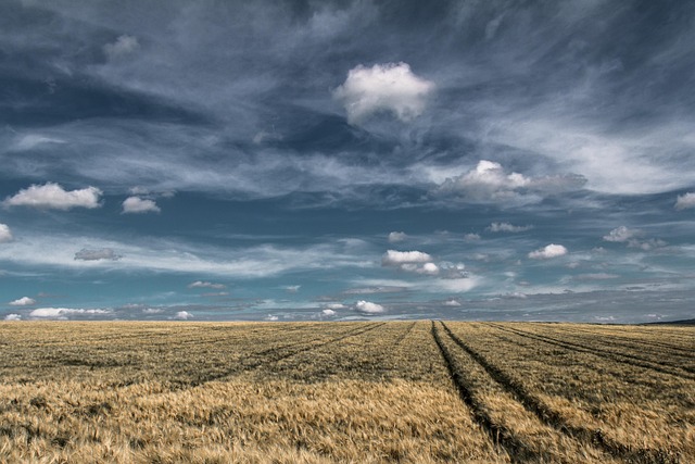
Precipitation patterns vary significantly across different landscapes due to complex atmospheric conditions and weather variations. One of the key factors is the interaction between fronts and their role in transporting moisture and energy. For instance, cold fronts often bring dry air from polar regions, leading to reduced precipitation, while warm fronts carry humid air from equatorial areas, resulting in increased rainfall. The El Niño Southern Oscillation (ENSO) further complicates these patterns, causing widespread changes in global weather systems. During an El Niño event, for example, eastern parts of North and South America experience more rainfall, while some Pacific islands suffer from droughts.
Atmospheric conditions also dictate the temperature measurement between humid and dry air. Surface-level temperatures heavily influence moisture content, with warmer air capable of holding more humidity. This is particularly evident in subtropical regions where high temperatures contribute to robust hurricane seasons characterized by intense precipitation. Conversely, drier landscapes like deserts experience lower humidity due to higher evaporation rates, leading to fewer weather fronts and less frequent rainfall.
Fronts and temperature variations play a crucial role in shaping local climates. For instance, the intersection of cold and warm air masses creates areas of low pressure, prompting atmospheric instability and increased precipitation. These dynamic interactions are further modulated by topographical features like mountains and oceans, which can block or funnel moisture-laden air, altering rainfall distributions. Understanding these complex relationships is essential for predicting weather patterns and managing water resources effectively. To gain deeper insights into humid vs dry air temperature measurements, visit us at humid vs dry air temperature measurement.
Regional Differences: Global Precipitation Trends
Precipitation patterns exhibit striking regional differences across the globe, influenced by a complex interplay of factors. Understanding these variations is crucial for predicting weather trends and their impacts on ecosystems and human societies. One primary driver is thermal dynamics in weather, where temperature gradients between land and water bodies create contrasting air masses leading to precipitation. For instance, coastal areas often experience higher rainfall due to the continuous cooling effect of oceans, moderating temperatures and enhancing moisture-holding capacity.
Regional disparities are also shaped by the weathering and erosion cycle. Mountains, for example, can capture and concentrate moist air masses from surrounding regions, resulting in heavier precipitation on windward sides compared to leeward slopes. This phenomenon is evident in the Pacific Northwest of the United States, where steep mountain ranges create dramatic variations in rainfall across relatively short distances. Additionally, atmospheric instability caused by strong temperature inversions or vertical wind shear can enhance precipitation, leading to localized heavy downpours or broader storm systems.
Global climate change further complicates these trends. Warmer temperatures increase atmospheric moisture content, potentially intensifying precipitation events worldwide. However, regional differences persist due to complex interactions between warming and local topographies. For instance, halos—concentrations of cloud droplets that form around tiny particles in the atmosphere—can significantly influence local weather patterns by altering microphysical processes in clouds. Understanding these dynamic relationships is paramount for adaptation and mitigation strategies, as communities must increasingly grapple with both more frequent and severe precipitation events and prolonged droughts.
Precipitation variations across landscapes are multifaceted, influenced by a complex interplay of topography, climate, land cover, and atmospheric conditions. Topographic features such as mountains can enhance or disrupt rainfall patterns through processes like orography and wind shadowing. Climate plays a pivotal role in shaping precipitation, with temperature differentials driving evaporative processes and modulating local weather naturally. The type and extent of land cover significantly impact water cycle dynamics, affecting evapotranspiration rates and local moisture balance. Atmospheric conditions, including pressure systems and frontal boundaries, further contribute to weather variations that drive precipitation events. Understanding these interconnected factors is crucial for predicting global precipitation trends and managing water resources effectively. This authoritative exploration provides valuable insights into the intricate dance of nature that determines how and where precipitation falls, empowering us to navigate and adapt to our dynamic planet’s weather naturally.